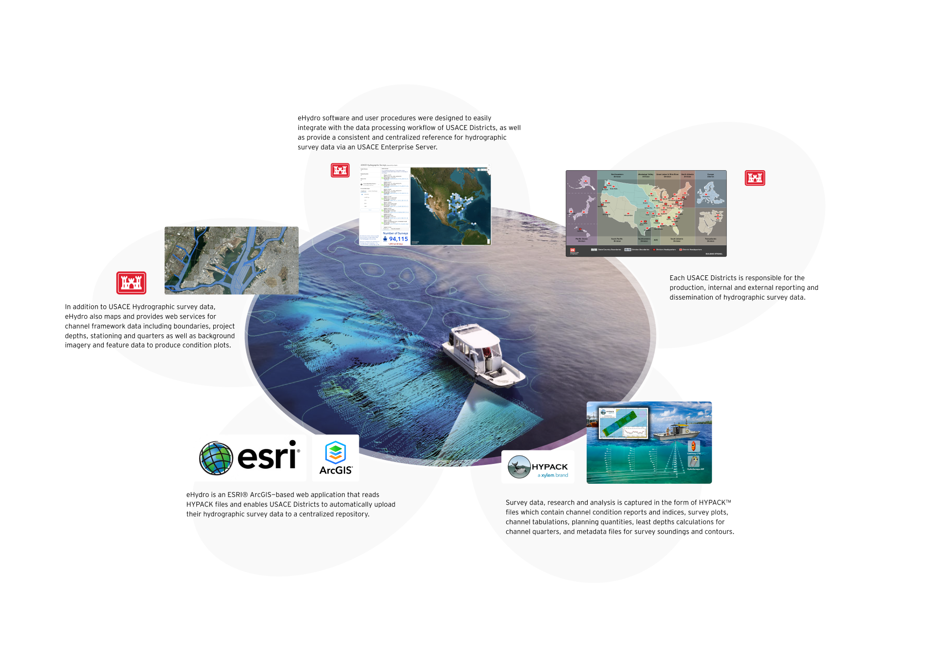
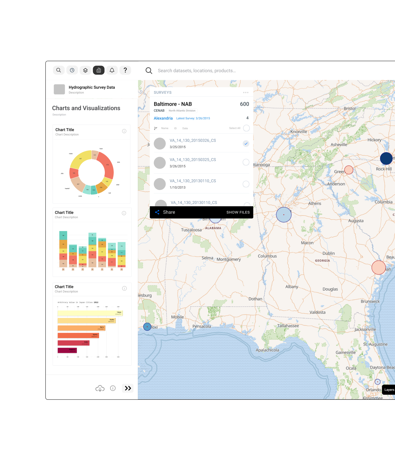
eEach USACE Districts is responsible for the production, internal and external reporting and dissemination of hydrographic survey data. In addition to USACE Hydrographic survey data, eHydro also maps and provides web services for channel framework data including boundaries, project depths, stationing and quarters as well as background imagery and feature data to produce condition plots.